
Cities & Metropolitan Areas
Understand Missouri’s major urban centers and the smaller regional cities that anchor local housing and employment markets.
Explore More ↓


(314) 724-2392
Real Estate Company
From the urban economies of St. Louis and Kansas City to the Ozarks, university cities, river towns, agricultural counties, lake communities and fast-growing suburban corridors, Missouri is a collection of distinct local markets. Those markets are shaped by different combinations of employment, transportation, education, geography, history and housing.


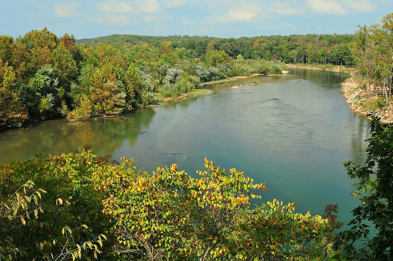
From the state’s largest metropolitan areas to university cities, agricultural counties, river communities, Ozark towns and lake markets, Missouri’s real-estate patterns reflect where people work, travel, study, recreate and build their lives.
Understand Missouri’s major urban centers and the smaller regional cities that anchor local housing and employment markets.
Explore More ↓
See how 114 counties, the independent City of St. Louis and distinct regional economies organize Missouri’s local markets.
Explore More ↓Explore the public, private, research, technical and community-college institutions that influence communities across the state.
Explore More ↓
Follow the interstate, rail, river, airport and freight systems connecting Missouri’s population centers and employment corridors.
Explore More ↓Learn how major metros, manufacturing, health care, finance, logistics, food production, bioscience and defense shape demand.
Explore More ↓From northern prairie and cropland to Ozark forests, clear streams, major rivers and lake markets, geography matters in Missouri.
Explore More ↓
Connect Missouri’s development eras and settlement patterns with urban neighborhoods, suburbs, small towns, farms, lake homes and newer growth.
Explore More ↓Place individual communities within the larger state story, from river settlement and railroads to Route 66, industrial growth and modern Missouri.
Explore More ↓Missouri’s statewide real-estate story is anchored by two major metropolitan areas and a collection of regional cities with their own employment bases, institutions, transportation networks and housing histories.
An independent city at the center of a larger metropolitan region with historic urban neighborhoods, major employment centers and an extensive suburban housing market.
Missouri’s largest incorporated city anchors a major interstate metro shaped by finance, logistics, health care, professional services and broad suburban growth corridors.
The principal metropolitan center of southwest Missouri, with major health-care, education, retail, services and regional employment markets.
A Central Missouri market strongly influenced by the University of Missouri, health care, research, state institutions and a growing professional-services economy.
Missouri’s capital city is shaped by state government, regional services, education and a housing market that serves both local and statewide institutions.
A Mississippi River regional center serving southeast Missouri through health care, higher education, commerce, transportation and established residential neighborhoods.
Missouri contains 114 counties, while St. Louis operates as an independent city outside any county. Use the County Atlas to see where each county is located, compare population, and continue into detailed County Guides as they become available.
Missouri’s central location and transportation network help explain where employment, logistics, manufacturing and residential growth concentrate. I-70 forms the major east-west spine between St. Louis, Columbia and Kansas City, while I-44 links St. Louis through Rolla and Springfield toward the southwest.
I-55, I-35, I-29, I-49 and I-64 connect additional metropolitan and interstate corridors. Major rail freight hubs, airports, river ports and navigable waterways add another layer of connectivity, influencing industrial development, commuting patterns and housing growth across the state.
Missouri’s economy is large enough that statewide figures can hide meaningful regional differences. St. Louis and Kansas City together account for roughly 58% of statewide employment, while central Missouri, the Ozarks and other regions have distinct industry mixes.
Missouri’s 2025 current-dollar GDP was about $468.5 billion. State research identifies real estate/rental/leasing, manufacturing, government, health care/social assistance and finance/insurance among the largest contributors to output.
Missouri’s statewide economic development strategy highlights five clusters with broad importance across the state.
Higher education influences housing, employment, health care, research activity and rental demand across Missouri. The state reports 13 public four-year universities alongside a broad network of community, technical, independent and specialized institutions.
Missouri’s public system reaches every major part of the state. The University of Missouri System alone includes Columbia, Kansas City, St. Louis and Missouri S&T in Rolla, while additional public universities serve Springfield, Cape Girardeau, Warrensburg, Kirksville, St. Joseph, Maryville, Jefferson City and Joplin.
Missouri also includes major independent and specialized institutions whose campuses and employment footprints are important to local real estate. Examples include Washington University in St. Louis, Saint Louis University, Webster University, Maryville University, Lindenwood University, Rockhurst University, Park University, Drury University, College of the Ozarks and others.
Official university websites open in a new tab.
Missouri’s physical geography changes dramatically across the state. Northern and western areas include prairie-influenced landscapes and extensive cropland; the southern half is dominated by the rugged, forested Ozarks; the southeast transitions into the flat Mississippi Alluvial Valley and Bootheel.
The Missouri and Mississippi rivers create major settlement and transportation corridors, while lake and outdoor-recreation markets such as Lake of the Ozarks, Table Rock Lake and Ozark stream country create very different housing and second-home patterns.
Missouri State Parks currently manages 93 state parks and historic sites with more than 160,000 acres and more than 1,000 miles of trail.
A statewide real-estate guide should not flatten Missouri into one housing type. The built environment reflects settlement era, transportation, local industry, topography, suburban expansion and rural land use.
Brick urban neighborhoods, nineteenth- and early-twentieth-century commercial districts, historic multifamily, revival styles, bungalows and dense prewar housing.
Ranches, split-levels, Cape Cods, traditional two-stories, attached garages and subdivision-based development dominate many twentieth-century growth areas.
Markets mix older neighborhoods, student and rental housing, established subdivisions, infill and newer peripheral growth.
Historic town centers, vernacular houses, farm communities, later subdivisions and locally specific architectural traditions.
Farmhouses, acreage, agricultural properties, outbuildings and land-use considerations become more important outside major urban systems.
Waterfront homes, second homes, cabins, condos, steep terrain, docks, private roads and recreation-driven development create specialized real-estate questions.
Missouri’s development history remains visible in its housing, street patterns and downtowns. Courthouse-square towns, railroad neighborhoods, industrial river cities, postwar subdivisions, university communities and lake developments each reflect a different period of growth and a different local identity.
Missouri and Mississippi River communities grew around trade, transportation and industry, leaving historic downtowns, warehouse districts and some of the state’s oldest residential neighborhoods.
Across much of Missouri, county seats became enduring centers for government, commerce and civic life, shaping traditional street grids and recognizable downtown districts.
Rail lines, factories and regional trade helped create neighborhoods and smaller cities whose housing stock still reflects late-nineteenth- and early-twentieth-century growth.
Postwar highways accelerated suburban expansion while reservoirs, tourism and recreation created newer lake, resort and second-home markets in other parts of the state.
Statewide patterns become most meaningful at the local level. Explore detailed Community Guides for housing, architecture, neighborhoods, local amenities, listings and home tours in individual Missouri communities.
Historic districts, architecture, downtown life, parks, schools, transportation, listings and Archway Abodes home tours.
Explore Kirkwood →Subdivisions, parks, schools, architecture, Manchester Road, transportation, listings and growing Archway Abodes home-tour coverage.
Explore Ballwin →Third-party photography used on this page is credited below. Source links open in a new tab.
Photo: Daniel Haim
License: CC BY-SA 4.0
View Source ↗Photo: CalendarGuy
License: CC BY-SA 4.0
View Source ↗Photo: Dylanchapell
License: CC BY-SA 4.0
View Source ↗Photo: Gina Strobel
License: CC BY-SA 4.0
View Source ↗Photo: Michael Gäbler
License: CC BY 3.0
View Source ↗Photo: Jatpainter1
License: CC BY-SA 4.0
View Source ↗Photo: BreathDriver
License: CC BY-SA 4.0
View Source ↗
Get instant property value now!